
Atikokan
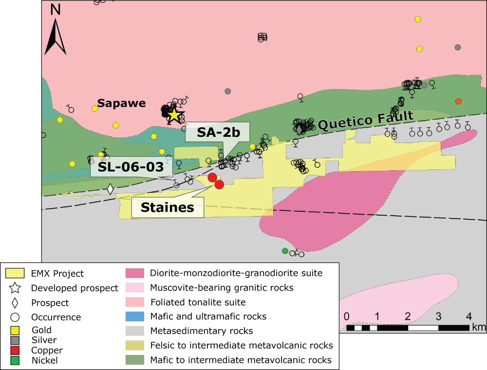
EMX’s Atikokan project is centred on the hamlet of Sapawe, 15 km E of Atkikokan and 145 WNW of Thunder Bay. The land position is road and boat accessible, covering ~ 10 km of the Quetico Fault.
The Quetico Fault separates the granite greenstone Wabigoon Subprovince from the metasediments and metasedimentary derived intrusions of the Quetico suprovince1. The Quetico fault is proximal to a number of mafic intrusive bodies called the Atikokan River Intrusions (ARI), which are a series of linear, ENE trending mafic to ultramafic intrusions prospective for Fe-Cu-Co-Ni mineralization in the Sapawe-Atikokan area.
The historical Staines occurrence (ARI) discovered in 1940 was explored with a five diamond-drill hole program, returning assays of up to 40% Fe and 0.8% Cu from 18.3 to 24.4 m*. Additional drilling was conducted in 2006, drillhole SL-06-03 reported 1.9 m at 1.05% Cu and 0.05% Co2.
In 2020, a heliborne magnetic and TDEM survey (140-line km) identified strong linear features interpreted to be related to iron formations and weaker linear magnetic anomalies-oriented ENE-WSW related to intermediate-mafic intrusives3.
*EMX has not performed sufficient work to verify the published assay data reported above, and these data cannot be verified as being compliant with NI43-101 standards. These historically reported data should not be relied upon until they can be confirmed, but EMX believes this information is considered reliable and relevant.
*Nearby mines and deposits provide context for the project, but do not necessarily indicate similar size, styles or grade of mineralization within the project.
*True thickness is unknown
(1) http://www.geologyontario.mndm.gov.on.ca/mndmfiles/afri/data/imaging/20000018200/20000018200_01.pdf
(2) https://www.mndm.gov.on.ca/sites/default/files/article_files/recommendations_for_exploration_2016_2017.pd
(3) https://www.geologyontario.mndm.gov.on.ca/mndmfiles/afri/data/imaging/20000019773/20000019773_01.pdf
Maps
 Click to Enlarge
Photos
©2024 EMX Royalty Corp. All rights reserved. | Website by Adnet | Privacy Policy | Web Accessibility Policy