
Agnew
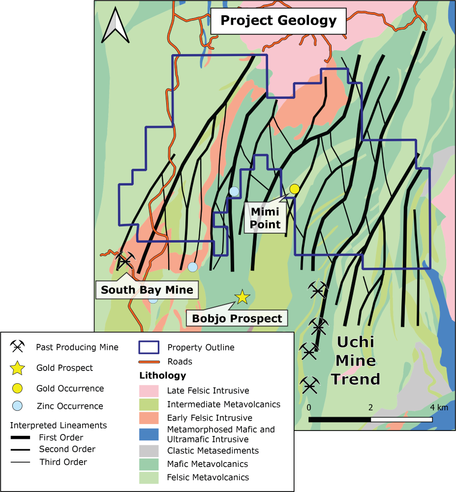
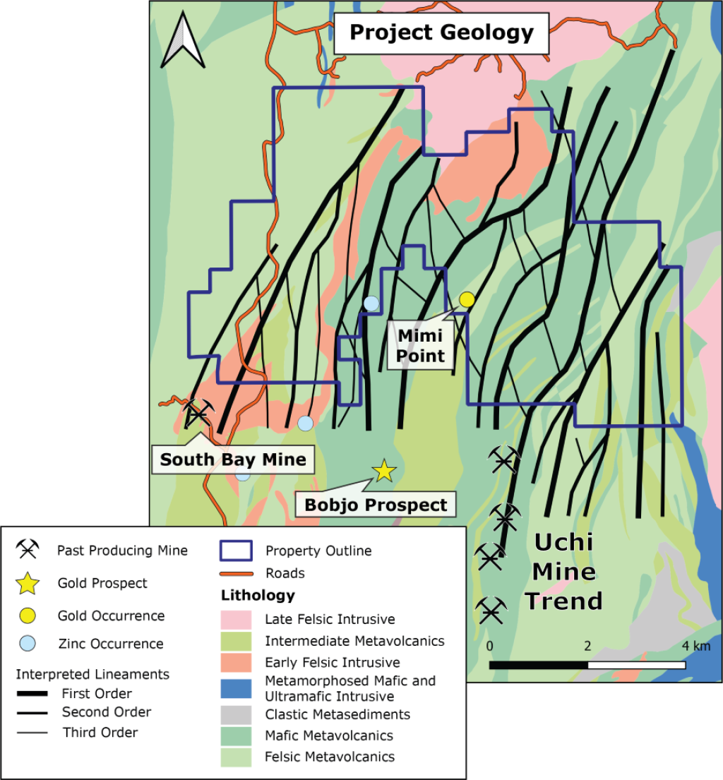
The Agnew property was staked in Dec. 2023. Located in the Birch-Uchi greenstone belt, comprised of 218 single cell mining claims, the project covers an area of ~4,600 ha. The property is prospective for orogenic gold, VMS and LCT pegmatite mineral systems. The western portion of the claim group covers bimodal volcanics, north of the past producing South Bay mine (1.6 Mt @2.3% Cu and 14.5% Zn)1.The central and western portion is along strike of the past producing Uchi Mine trend (past production of >100,000 oz Au) and contains the only known gold occurrence on the property (samples of up to 13.0 g/t at Mimi point showing)(n=10, avg=5.15 g/t Au)2,3. The property is accessible by logging roads from the north and boat in the central portion. Angold held a similar land position from 2019 until fall 2023, the only work completed was a VTEM survey and structural interpretation. A first pass of the new property will be completed in the upcoming 2024 field season to validate the Mimi point showing, as well as assessing the targets generated by Angold. The western portion of the property is within 10 km of the peraluminous Allison Lake Batholith and is considered prospective for LCT pegmatites.
*Nearby mines and deposits provide context for the project, but do not necessarily indicate similar size, styles or grade of mineralization within the project.
¹ https://skyharbourltd.com/_resources/SYH_SOUTH_BAY_MINE_PROJECT-May2008.pdf?v=0.109?v=0.972?v=0.804?v=0.433
² Parker, J.R., and Atkinson, B.T., 1992, Gold Occurrences, Prospects and Past Producing Mines of the Birch-Confederation Lakes Area, Ontario Geological Survey, Open File Report 5835, 332p
³ https://www.geologyontario.mndm.gov.on.ca/mndmfiles/mdi/data/records/MDI52N02NE00015.html
Maps
 Click to Enlarge
Photos
©2025 EMX Royalty Corp. All rights reserved. | Website by Adnet | Privacy Policy | Web Accessibility Statement