
Antelope, Nevada
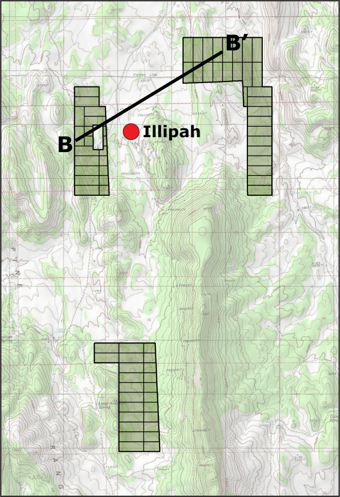
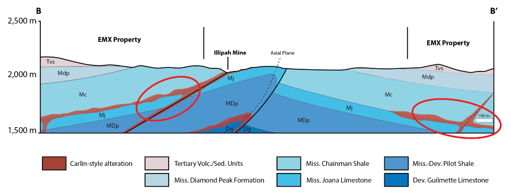
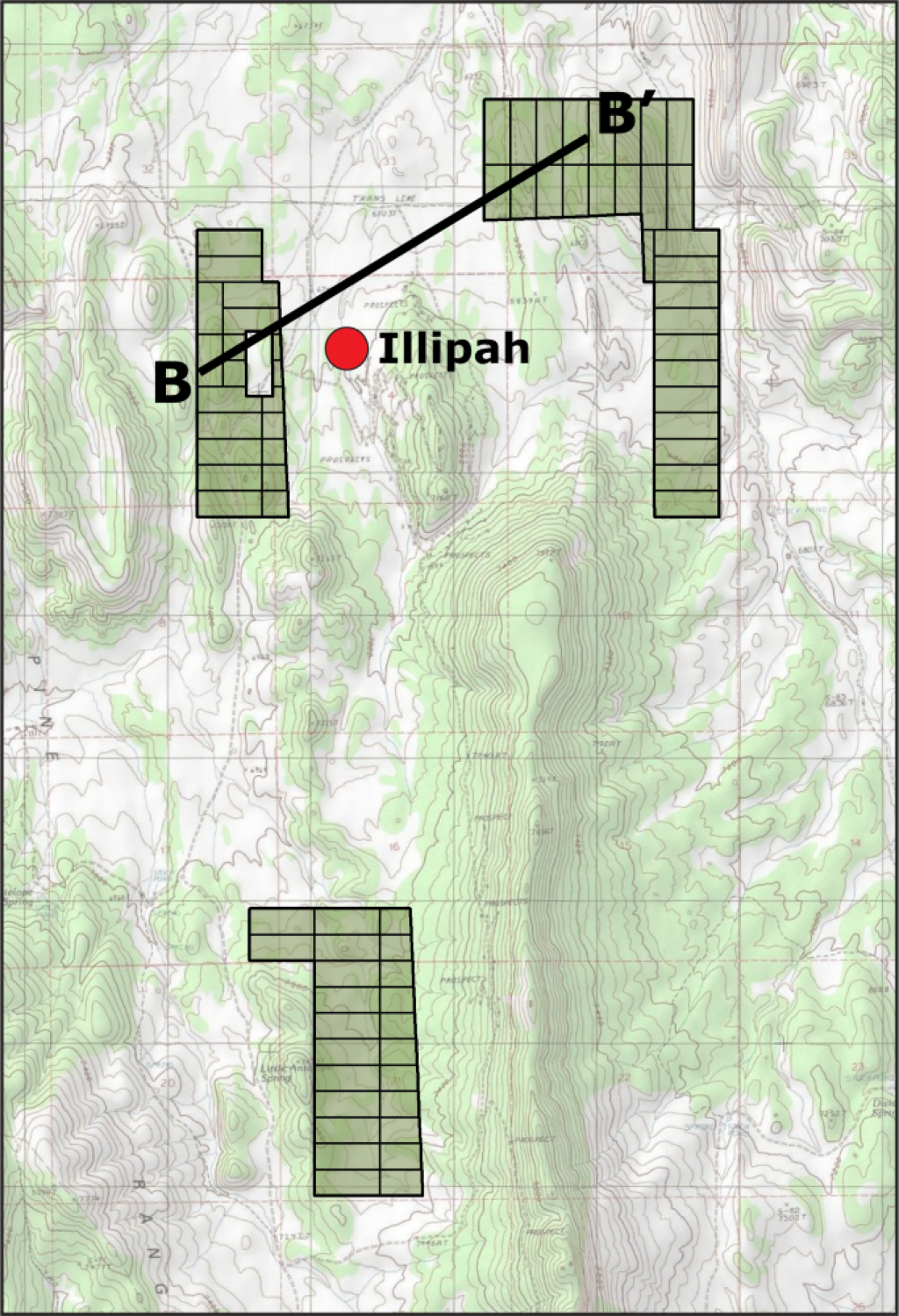
EMX’s Antelope Project surrounds the historical Illipah Mine claim block. EMX’s land position targets the along-strike extension of the anticline that hosts the historical Illipah Mine. The stratigraphic package on the property includes the Mississippian Chainman Shale, Joana Limestone, Pilot Shale, and the Devonian Guilmette Limestone, which comprise the host rocks at nearby past-producing Carlin-type mines (Alligator Ridge, Pan, Gold Rock, and Illipah). The Chainman-Joana and the Pilot-Guilmette contacts are known to be the most prolific host horizons regionally. The historically mined area at the Illipah deposit was below the Chainman-Joana contact, as the core of the anticline has been eroded. However, ENE-trending normal faults have downdropped this highly prospective contact to the north onto EMX’s land position, where it is preserved. Where these ENE-trending faults intersect favorable stratigraphy or secondary structures on the Antelope Project, higher-grade gold mineralization is expected to occur.
There is widespread jasperoid, gossan, decalcification, and ferroan carbonate alteration across the property; the footprint of the alteration indicates a large-scale hydrothermal system that extends beyond the known Illipah gold deposit.
The Antelope project has both near-surface oxide potential, as well as high-grade feeder targets at depth. Recent work completed on the property includes detailed geologic mapping, geochemical sampling, an IP survey, and RC drilling.
*Nearby mines and deposits provide context for the project, but do not necessarily indicate similar size, styles or grade of mineralization within the project
Maps
 Click to Enlarge
 Click to Enlarge
©2025 EMX Royalty Corp. All rights reserved. | Website by Adnet | Privacy Policy | Web Accessibility Statement