
Bispgården
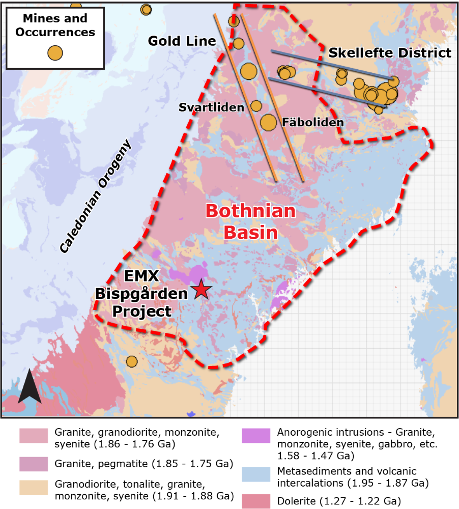
EMX’s Bispgården Project is hosted in the Paleoproterozoic Bothnian Basin, which is also host to the prolific ‘Gold Line’ greenstone belt further to the north. The mineralization style of the Bispgården Project is analogous to orogenic-style occurrences in the Gold Line.
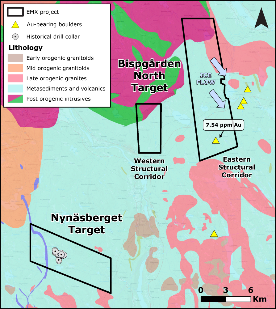
There are two main target areas at Bispgården – Nynäsberget and Bispgården North. Nynäsberget has a wide shear zone envelope with several individual zones showing strong silicification and calc-silicate alteration hosted in a marine metasediment. Regional sampling by the SGU in 1985 identified a 7.5 g/t Au boulder in the area, leading to follow-up work in 1986 where gold was discovered in an outcrop at Nynäsberget. A composite sample covering the 15 m wide intersection gave an average assay of 2.5 g/t Au1. The first three holes at Nynäsberget were drilled in 1986, which all intersected Au mineralization at shallow depths (best intercepts – 86001: 3.15 m @ 1.41 g/t Au, 19.1 m depth; 9.2 m @ 1.15 g/t Au, 4.5 m depth)2. A total of 50 drillholes were drilled at Nynäsberget, which primarily focused on the discovery outcrop. Historical drilling identified several altered zones over a 1 km strike, however previous work neglected to pursue mineralization along strike and down dip. In 1990, ground magnetic surveys imaged the mineralization as a moderately magnetic anomaly.
EMX recognized evidence for two structural corridors at the Bispgården North target that may control gold mineralization through a combination of regional datasets and field observations.The Bispgården North target area has never been explored, however a broad gold-in-till anomaly (> 50 km2) has been identified and is coincident with a 2 km trend of gold-bearing boulders (0.49 – 12.7 g/t Au; n = 5), which is perpendicular to the ice flow direction3. Previous exploration focused on the area immediately adjacent to the boulders, but did not target the source rocks, which EMX believes lie in the structural corridor to the west.
Maps
 Click to Enlarge
 Click to Enlarge
1 PRAP 87508 page 8.
2 PRAP 87508 page 12. Soil sampling data from NSG and SGU are available in the public domain together with the historic drilling data. All reports are available through the SGU document download portal at https://www.sgu.se/produkter-och-tjanster/soktjanster/geolagret/ The relevant reports are PRAP 87042, PRAP 87508, PRAP 87509, PRAP 90032, NSG 91062, NSG 92003 and S 8701. True widths are unknown.
3 Historical soil and boulder sampling was conducted by the Swedish Geological Survey (SGU).
Note: EMX has not performed sufficient work to verify the published assay data, and these data should not be considered as being compliant with NI43-101 standards. These data should not be relied upon until they are confirmed, however EMX considers the data to be reliable and relevant.
*Nearby mines and deposits provide context for the project, but do not necessarily indicate similar size, styles or grade of mineralization within the project.
©2025 EMX Royalty Corp. All rights reserved. | Website by Adnet | Privacy Policy | Web Accessibility Statement