Reinfjord and Stjernøya
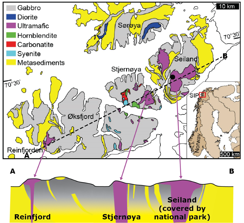
The Seiland Igneous Province includes both the Reinfjord and Stjernøya intrusive complexes. Reinfjord has seen limited exploration, whereas Stjernøya is entirely untested.
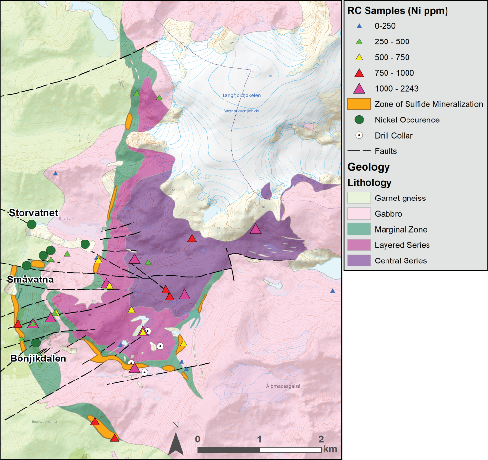
The Reinfjord Intrusive Complex is a large (5,500 km2) layered mafic intrusive complex in northern Norway, interpreted to be Neoproterozoic in age. Exposed within the intrusive complex are an upper, central and lower layered series, as well as a basal “marginal series”. Nickel sulfide occurrences are well known in this complex and are largely positioned within the basal marginal rocks. Mineralization has been historically described as “reef-style” and disseminated types. A mineralized interval within the marginal series is described as being 20 meters thick in some locations with a documented strike length of over 2km.
No exploration appears to have been conducted prior to 2011, when Nordic Mining commenced a program in the area. Nordic ran geophysical surveys including SkyTEM and ground based EM and drilled four reconnaissance holes within the complex. Three of the four holes intersected “reef” or disseminated styles of mineralization, including both Ni-Cu rich and PGE rich horizons. However, the holes that intersected sulfide mineralization did not appear to penetrate the basal contact of the layered intrusive complex. A prominent EM conductor in the center of the complex was not tested and the reconnaissance holes were not followed up.
After the reconnaissance drill program, Nordic Mining chose to focus on development of its Engebø rutile deposit in southern Norway which is entering the development phase. EMX acquired the licenses afterward.
Regional gravity surveys and work by the Norwegian University of Science and Technology (NTU) and the Luleå University of Technology (LTU) suggest both the Reinfjord and Stjernøya intrusive complexes are feeder conduits for the greater Seiland Igneous Province.
Note: Historic rock chip sampling was completed by the Norwegian Geologic Survey. EMX has not performed sufficient work to verify the published assay data reported, and these data cannot be verified as being compliant with NI43-101 standards. These data should not be relied upon until they are confirmed, however EMX considers the source reliable and relevant.
The geologic map was completed by Falconbridge in 1972, reported by the NGU in Rapport Nr. BV463, and digitized by EMX Royalty Corp.
Maps
Photos

 Click to Enlarge
 Click to Enlarge